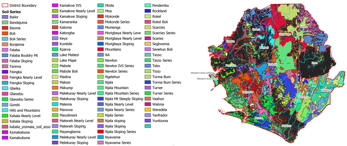
National Soil Information System (NaSIS) - Sierra Leone

NaSIS is an integrated, centralized, geospatial digital platform that turns raw soil data into useful, interactive tools, maps, and insights. NaSIS was established to ensure that the results of the National Comprehensive Soil Survey (NCSS) and related soil data going forward are accessible, usable, and impactful.

Geospartial Maps

Provides interactive geospartial maps visualizng and dissemination soil resource information for agricultural productivity.

Soil Suitability

Provides maps and data showing soil suitability and areas for cultivating specific crops in Sierra Leone

Soil Data and Resource

A one-stop-shop for storing, managing and accessing soil resource information for sustainable and climate resillent agriculture

Soil Map SL
Soil Map SL

Updates and Information

News, Articles and Publications about SIMS and related services